← Back
Dengue Spatial & Statistical Analysis
Comprehensive GIS-Based Study of Dengue Distribution in Colombo City
Project Overview
This project presents a comprehensive spatial and statistical analysis
of dengue distribution in Colombo City, Sri Lanka.
By integrating multiple GIS and spatial statistics techniques, the study
examines spatial patterns, clustering behavior, and directional trends
of dengue cases to support evidence-based public health decision-making.
Study Area
The study area covers Colombo City, the commercial capital of Sri Lanka.
Rapid urbanization, high population density, and mixed land use patterns
contribute to favorable conditions for dengue transmission, making the
city a critical area for spatial epidemiological analysis.
Data Sources
- Secondary dengue patient location data
- Mosquito breeding site data
- Colombo city administrative boundary data
- Land use and base map layers
Methodology
- Mean center and median center analysis
- Standard distance and standard deviational ellipse
- Kernel density and point density mapping
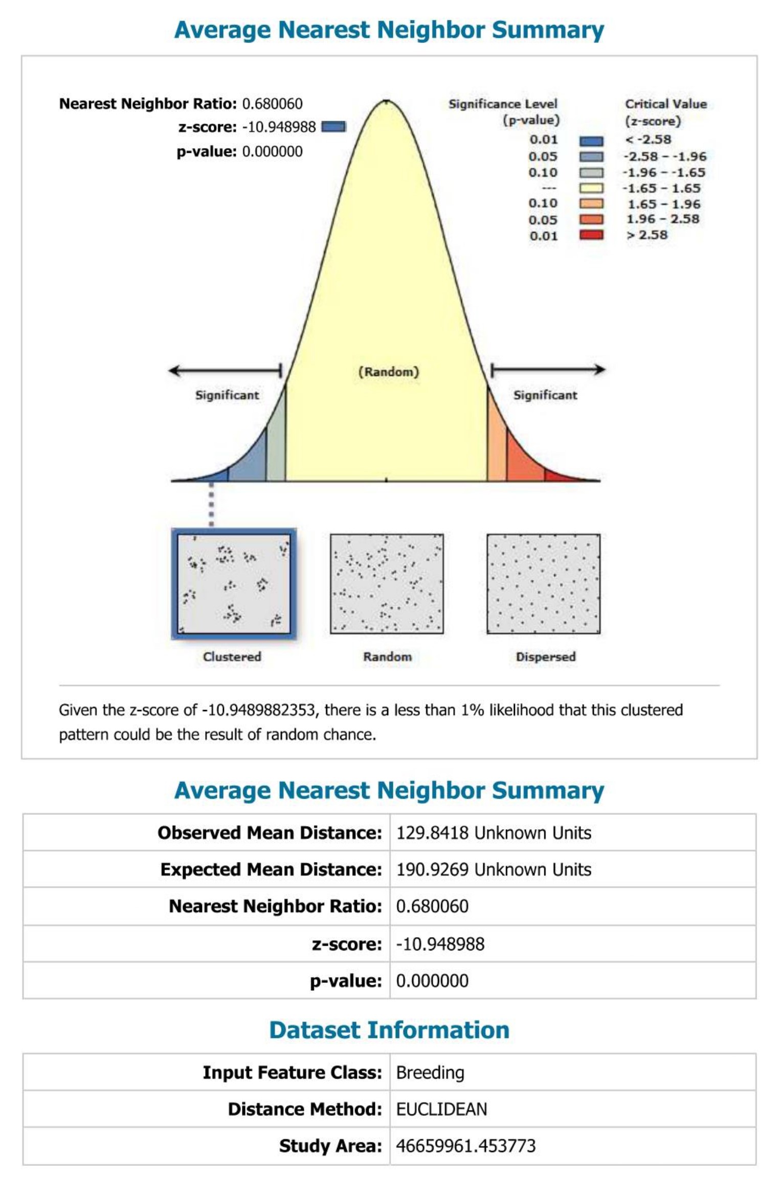
- Nearest neighbor analysis
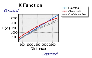
- Multi-distance spatial cluster (K-function) analysis
Spatial Analysis Maps
The maps collectively illustrate the spatial distribution, clustering,
dispersion, and directional trends of dengue prevalence and breeding
sites across Colombo City. Density and clustering analyses reveal
statistically significant hotspots requiring targeted public health
interventions.
Key Findings
- Dengue cases show significant spatial clustering within Colombo City
- Kernel density maps identify high-risk dengue hotspot zones
- Nearest neighbor analysis confirms non-random clustered patterns
- Directional ellipses reveal dominant trends in disease spread
- Land use patterns influence dengue distribution and intensity
Tools & Skills
- ArcGIS Desktop 10.8
- Spatial Statistics & Spatial Analyst tools
- Disease mapping and hotspot analysis
- Cartographic visualization and map layout design
Conclusion
This project strengthened practical skills in spatial epidemiology,
GIS-based statistical analysis, and thematic cartography.
The integrated approach provides valuable insights into dengue
distribution patterns and supports informed decision-making for
urban public health planning.
.jpg)